After record rain, Lexington, parts of Kentucky are likely to get snow Sunday night
After rainfall broke some records this weekend, Central Kentucky can expect wind gusts and probably wet snow overnight into Monday, according to WKYT chief meteorologist Chris Bailey.
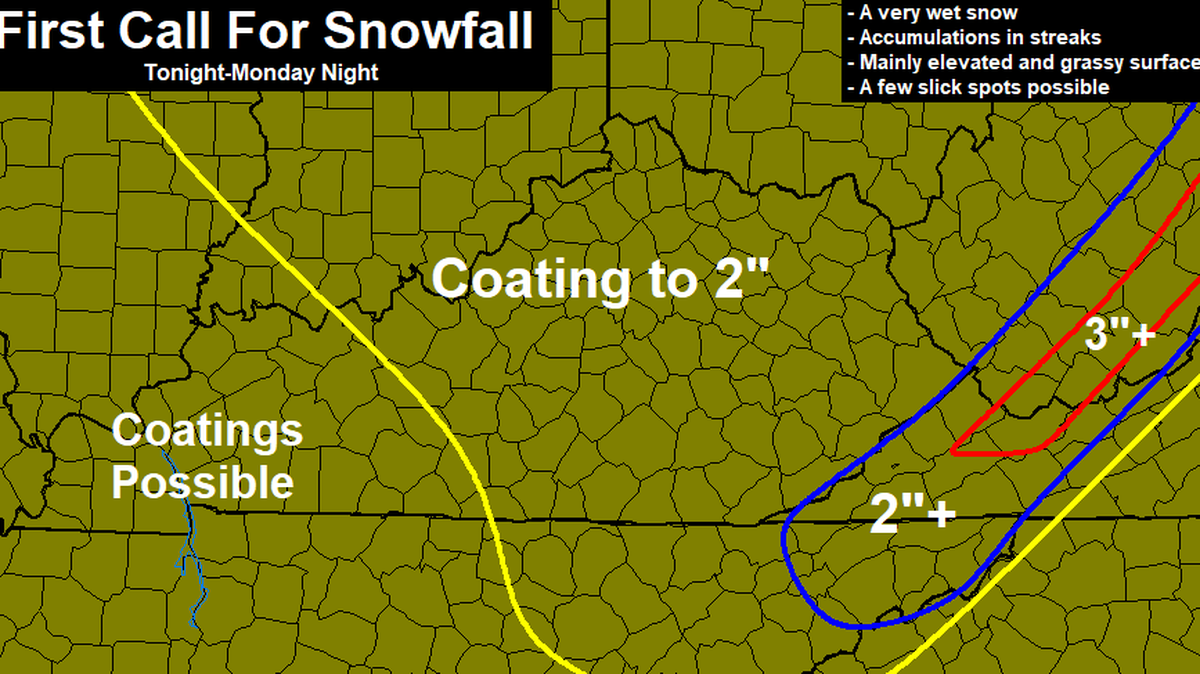
Widespread coatings to 2 inches of snow are possible in Central and Eastern Kentucky as temperatures decline Sunday into Monday, Bailey said. Snow showers or flurries are likely to continue through Monday.
The snow arrives after many areas picked up 2 inches to 4 inches of rain Saturday. Lexington broke the record for the wettest Nov. 30 on record with nearly 3 inches of rain.
Bailey’s weather blog has the forecast.
The National Weather Service’s Louisville office also forecasts a shift from rain to snow Sunday night, though they project totals closer to one 1 inch of snow in some counties and less than half an inch in others. Some of the counties the that could get up to an inch include Madison, Garrard, Lincoln and Boyle counties, according to the weather service.
This story was originally published December 1, 2019 at 9:08 AM.