Rain, storms, flash flooding likely this week for Central KY. What to know
Another round of rain showers and thunderstorms are set to hit Kentucky this week.
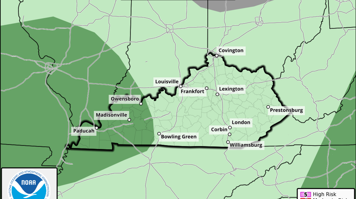
The system of lower temperatures from the northwest bringing rain could cause local flash flooding issues that may last into the weekend.
In a blog post early Monday morning, WKYT Chief Meteorologist Chris Bailey said, “A cold front drops into the region today, bringing scattered showers and storms along for the ride. This front slows down and stalls as waves of low pressure roll along it this week and into the weekend.”

The combination is likely to spawn the potential for flash flooding because much of the state is likely to pick up between 1 and 3 inches of rain this week. Bailey says slow-moving storms are the main concern because they can drop a lot more than 3 inches in just a short period of time.
Widespread severe storms are not part of the forecast, but Bailey said, “We may see something similar to a few weeks ago with pulse severe storms go up and produce hit-and-run wind damage.”
According to a two-week rainfall forecast, additional rain showers and storms may show up again next week, too, and some models already show the Southeast will have above normal rainfall through mid-August.
Flash flooding explained
Flash flooding is most common in Kentucky in July and August and is driven by slow-moving thunderstorms that dump water on low-lying areas quickly. The event is characterized by its speed and applies to heavy rainfall that occurs in less than six hours causing sudden rushes of water to overwhelm streams and streets.
Flooding can happen anywhere since heavy rain eventually follows natural waterways and moves downstream that can swell those small backyard streams and creeks.
In a flash flood, it’s generally recommended those in low-lying areas seek higher ground. If you’re in your car, don’t drive through a flooded road — turn around, don’t drown.
Avoid swimming in flooded waters as they typically carry debris and sometimes sewage. Stay away from down power lines and evacuate if necessary.
Recent flash flooding in Kentucky
Earlier this year in April, widespread flash flooding occurred across the lower Ohio Valley, which includes all of Kentucky.

Due to excessive rainfall over the course of three days, the basins of the Kentucky, Green, Rough, Rolling Fork and Ohio rivers flooded. According to the National Weather Service, Central Kentucky was especially hit hard. Flash flooding then killed seven.

In July 2022, several thunderstorms developed south of I-64 bringing deadly heavy rain and flash flooding to Eastern Kentucky and Central Appalachia. Meteorologists documented historic rates of nearly 4 inches of rain per hour.
Over a five-day period, estimates suggest that upwards of 16 inches fell in parts of the area, with most cities and towns receiving about 10. During the rain, 24 flash flood warnings were issued. There were at least 39 deaths and widespread damage to the area.
Fast-moving water that swept through Texas over the Fourth of July weekend, killing at least 82, was a flash flood.
This story was originally published July 7, 2025 at 10:40 AM.
.JPG)