We have archive photos of Lexington. Tell us what areas you’d like to see recreated
READ MORE
See how Lexington has changed
Lexington, the Horse Capitol of the World, was founded in 1775. That’s 17 years before Kentucky was even a state. Just going back 40 years will give you an idea of how much the city has evolved.
Expand All
Skyscrapers, busy roads, iconic Lexington spots. See how city has changed in 40 years
We have archive photos of Lexington. Tell us what areas you’d like to see recreated
Then and now: Drone photos show how Lexington has grown, changed in 40 years
Aerial photos: Lexington landmarks from 1982

Take a look at the musical acts, performances and more coming to Central KY this fall
Who doesn’t love going down memory lane?
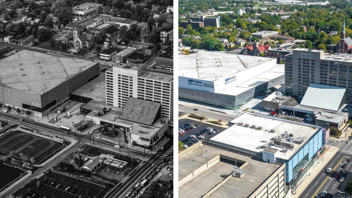
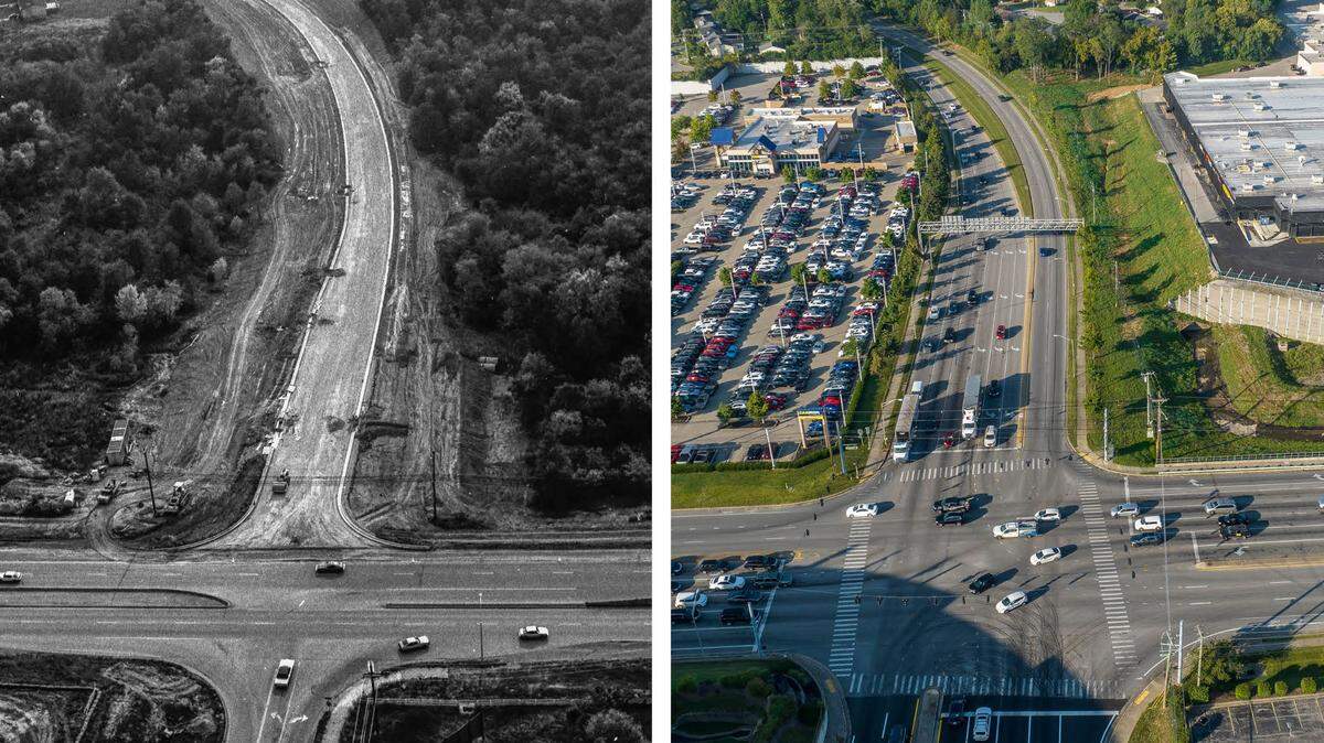
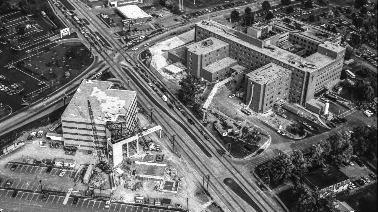
Our staff couldn’t resist when we discovered an assignment given to Herald-Leader photographer John C. Wyatt 40 years ago.
Wyatt photographed three rolls of black and white film high above Lexington, shooting aerial pictures of road construction and a few landmarks while he was up there. We photographed the same locations with our drone and the change and growth in Lexington since that October 1982 day was striking. From Man o’ War Boulevard construction to downtown without skyscrapers we have been used to for years, it was obvious Lexington has evolved.
So it got us thinking, what areas of town do you want to see then-and-now comparisons? Have you ever wondered what Fayette Mall looked like before it was a shopping destination? Or are there other Lexington landmarks that you would like to see how they have changed over time?

What place or area around Lexington would you like to see as then-and-now photos?
Tell us your answers in this poll and it might appear in a future Herald-Leader article. But a bit of a disclaimer: we may not be able to find an archive picture to compare changes to and some areas may have restricted air space to drone.