State of emergency declared as ‘treacherous storm’ of snow, sleet and ice set to hit KY
READ MORE
Kentucky is hit with significant winter storm
The National Weather Service has issued a winter storm watch for many areas of the state.
Expand All
You can find the latest updates and news on the winter storm in Kentucky as of Sunday morning here.
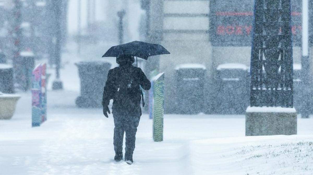
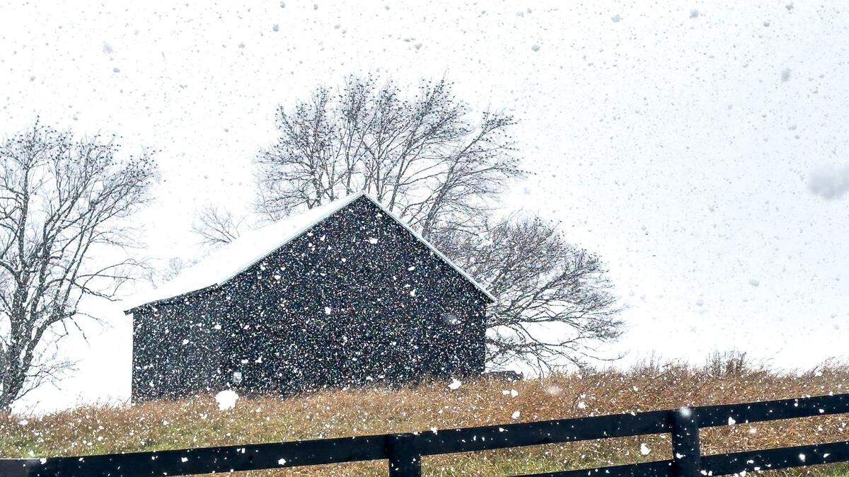
Brace yourself, Kentucky: Almost all of the commonwealth is under a winter storm watch as a powerful storm system expected to hit the state Sunday gets closer.
In the latest iteration of its winter storm watch Saturday morning, the National Weather Service said the storm likely will be an ugly one, hammering the commonwealth with a wintry mix of snow, sleet and freezing rain. The watch is in effect from Sunday morning through the morning of Tuesday, Jan. 7.
The storm will affect all parts of the state, but Northern-Central Kentucky is expected to see the harshest weather, including snow and ice accumulation.
The nasty conditions are part of a massive 1,300-mile system that likely will affect an estimated 62 million people. National meteorologists expect it to bring treacherous conditions from the Plains to the East Coast, starting over the weekend.
In parts of the country, as many as 12 states, the storm will bring a treacherous mix of snow, ice and blizzard conditions with winds gusting up to 40 mph.
On Friday and again Saturday afternoon, Gov. Andy Beshear encouraged people to be weather aware and plan ahead.
“Keep an eye on the weather throughout the weekend, as significant accumulations of ice and snow will be possible across a majority of the commonwealth, especially in North Central Kentucky,” Beshear wrote in a post on X.
“We know the best way to stay safe is to be prepared.”
Joined by other senior administration leaders, Beshear on Saturday afternoon warned about the “very disruptive winter storm and concerning forecast.”
“We need to prepare for the worst and hope for the best,” Beshear said, adding Kentucky National Guard units have been activated in anticipation of the storm.
The public transportation moves and growing concerns come as a mass of arctic air is expected to send temperatures plummeting across much of the country this weekend and into next.
Here are the latest updates:
Beshear declares state of emergency; activates National Guard units
1:45 pm Saturday, Jan. 4 -- Bracing for a treacherous storm that is expected to arrive early Sunday morning, Kentucky Gov. Andy Beshear activated National Guard units, declared a state of emergency and reassured residents the commonwealth is ready for Mother Nature’s wrath.
“This is a storm that must be taken seriously, and we are throughout the state,” Beshear said in a Frankfort news conference. “This is going to be a major, difficult winter storm.”
Beshear said the state has taken several steps in addition to activating Guard units. That includes pre-positioning snow and ice removal crews around the commonwealth, signing an executive order to prevent price gouging at the gas pump or grocery stores; and having about 2,300 state workers and contractors poised to clear roads.
He also said it’s possible state offices could be closed Monday.
Crews already have hit the state’s highways, spreading thousands of gallons of salt brine and other chemicals in anticipation of fast-approaching ice and snow storm.
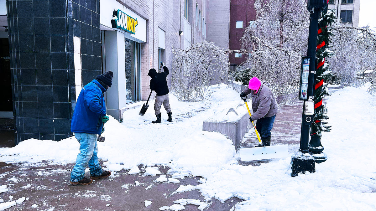
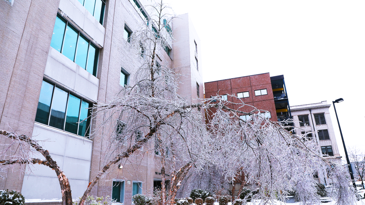
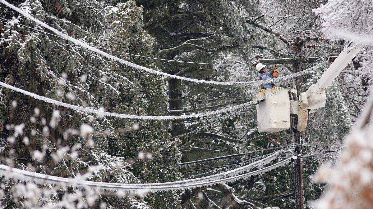
10 a.m. Saturday, Jan. 4 — In its 4 a.m. update, the National Weather Service office in Jackson warned the winter storm beginning Sunday could bring power outages and tree damage, and travel may be “nearly impossible” during the Monday morning and evening rush hours.
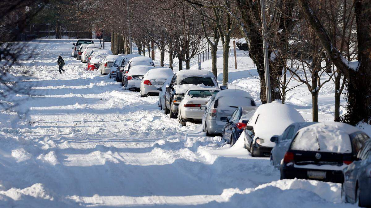
North-Central Kentucky is still forecast to see some of the harshest weather from the storm, with snowfall expected between 6 and 10 inches and ice accumulation of up to a quarter of an inch.
South of that region, in a band of counties that includes Fayette, more ice is expected, with accumulations exceeding a quarter of an inch, while snowfall is forecast at 3 to 6 inches.
The bitter cold temperatures following the storm are forecast to continue through Friday, Jan. 10.
“Some locations in southern Indiana and north-central KY may drop slightly below zero Wednesday night, especially with snow on the ground,” the latest advisory says.
Those very cold temperatures could be especially tough for areas that experience power outages, and the NWS encouraged residents to prepare ahead and protect their pipes from freezing.
More of Kentucky now included in winter storm watch
3:30 p.m., Friday, Jan. 3 — Boyd, Carter, Greenup and Lawrence have been added to the winter storm watch in anticipation of Sunday’s significant winter storm, meaning every county in Kentucky is now included in the watch.
The NWS office in Charleston W.Va., which oversees those four counties, said snow accumulations between 5 and 9 inches and ice accumulations up to one-tenth of an inch possible. The watch is in effect from Sunday morning though Monday evening.
NWS shares updated forecast, snow accumulation estimations
3 p.m., Friday, Jan. 3 — The NWS office in Louisville has updated its forecast for Sunday’s severe winter storm and is calling for 3 to 6 inches of snow in Lexington.
The most northern Kentucky counties bordering Indiana could get 6 to 10 inches of snow, according to the NWS. Areas south of Lexington are expected to get 1 to 3 inches, while the farthest southern Kentucky counties are expected to get less than an inch.
Fayette County is in the projected path for the harshest ice accumulation, between a quarter and three-quarters of an inch, according to the NWS. Areas south of Central Kentucky are expected to get no more than a quarter-inch of ice accumulation.
The storm is expected to begin Sunday morning with a snow/sleet mix in Northern-Central Kentucky. The precipitation will transition over to ice and wintry mix later in the day before ending with another round of snow and sleet Monday morning.
Southern Kentucky will get the ice and wintry mix, rain and snow during the storm’s appearance, according to the NWS.
‘Our city is prepared.’ Lexington officials share winter storm plans
2:30 p.m., Friday, Jan. 3 — Lexington leaders say the city is prepared for Sunday’s incoming severe winter storm and encouraged residents to do the same.
“Prepare about five days worth of food, water, medications, pet food, diapers, anything that you need around your household,” emergency management Director Rob Larkin said during a Friday afternoon press conference. “Roads may be difficult to drive on and staying home may be your safest option.”
Crews with the Lexington streets and roads division began pretreating hills and ridges with salt brine Friday, according to the division’s director, Rob Allen. More crews are coming in Saturday to continue.
“We are fortunate that this isn’t going to start out as a rain event, and that will allow us to get the salt brine and the beet heat mixture down,” Allen said.
All applicable staff will be on-call beginning after midnight Sunday and the day shift will report at 7:30 a.m., Allen said. He is anticipating three, complete 12-hour shifts from his crews.
There are approximately 1,174 lane miles of streets in the city and each street is ranked based on priority. The major roads, like Main Street, Nicholasville Road and Richmond Road will be plowed first and Allen asked for the community’s patience while his crews treat the roads.
“Our priority roads are designed to be completed in about 48 hours after the snow stops, so please be patient with us on the major thoroughfares as we continue to treat as it continues to snow,” Allen said.
The Lexington fire and police departments are fully staffed and prepared for the storm. Fire Chief Jason Well said the fire trucks have been winterized and assistant police chief Shawn Coleman said officers have special equipment for traffic control in case of power outages.
Larkin said his department has been in contact with LGE & KU and they have 500 total resources prepared for the storm.
“Our city is prepared for what is going to come our way,” Mayor Linda Gorton said. “We make investments each year in salt, equipment and facilities to ensure that we’re always ready.”
NWS expands winter storm watch area
1:35 p.m., Friday, Jan. 3 — The winter storm watch in anticipation of a strong sytem arriving Sunday has been expanded to include Eastern Kentucky.
The NWS office in Jackson issued the watch at 1:35 p.m. Friday. It will go into effect Sunday morning and last through Tuesday morning.
Heavy wintry mix and 2 to 6 inches of snow accumulation is expected in the area, according to the agency. Ice accumulations between one quarter and one half of an inch are also possible.
All counties in Kentucky are now included in the winter storm watch except Boyd, Carter, Greenup and Lawrence. Those counties are under the coverage area of NWS Charleston, W.Va.
WKYT chief meteorologist Chris Bailey’s latest forecast
12 p.m., Friday, Jan. 3 — The latest projections from Bailey show the storm’s effects farther south than the models originally expected. He expects the lower part of the storm to go from the Memphis, Tenn., area to near Pikeville and then into southern West Virginia.
Bailey projects a powerful winter storm that will bring “significant amounts of snow, sleet and freezing rain to much of Kentucky.” He said he plans on issuing his first call for snow and ice accumulations at 4 p.m. Friday.
Bailey also questioned why the winter storm watch doesn’t include eastern Kentucky.
The NWS office in Louisville said it has expanded its winter storm watch to all counties in its coverage area, including Bowling Green.
Forecast for the next 48 hours
7 a.m., Friday, Jan. 3 — The high temperature for Friday is expected to reach 36 degrees, according to the NWS’ seven-day forecast for Lexington. It’s expected to gradually become mostly sunny throughout the day and include wind gusts up to 25 MPH.
Similar, sunny, conditions should be present Saturday, with the high expected to reach 30 degrees. The low is expected to be around 22.
The winter storm is expected to begin Sunday morning. The NWS said it will start out as a round of snow before transitioning over to a wintry mix Sunday afternoon. The mix is expected to persist Sunday afternoon and evening before the storm ends with another round of snow Monday morning, according to the NWS.
NWS puts parts of Kentucky in winter storm watch
3:16 p.m., Thursday, Jan. 2 — The NWS has issued a winter storm watch for northern-central Kentucky counties in preparation for Sunday’s significant storm.
The watch will begin late Saturday night and last through Monday afternoon. The NWS said areas in the watch area can expect 4 inches of snow and sleet accumulation, as well as ice accumulations of greater than a quarter of an inch.
Traveling may become impossible during the height of the storm Sunday, according to the NWS. Power outages and tree damage are also possible.
Early projections of the storm
3 p.m., Thursday, Jan. 2 — The first round of the storm is expected to feature snow Sunday morning, but later in the day the precipitation will transition over to a wintry mix along and north of the Interstate 64 corridor into southern Indiana.
The northern half of Kentucky could experience significant icing as well, mainly along and north of the Western Kentucky and Bluegrass parkways, according to the NWS. The storm will conclude with another round of snow Monday morning.
Areas of southern Kentucky will see snow, ice and even a transition over to rain for a time.
Hazardous traffic conditions and infrastructure issues can be expected, according to the NWS.
CORRECTION: This story and headline were updated at 6 p.m. Jan. 3 to correct that the latest winter storm watch includes almost all Kentucky counties.
This story was originally published January 2, 2025 at 4:09 PM.