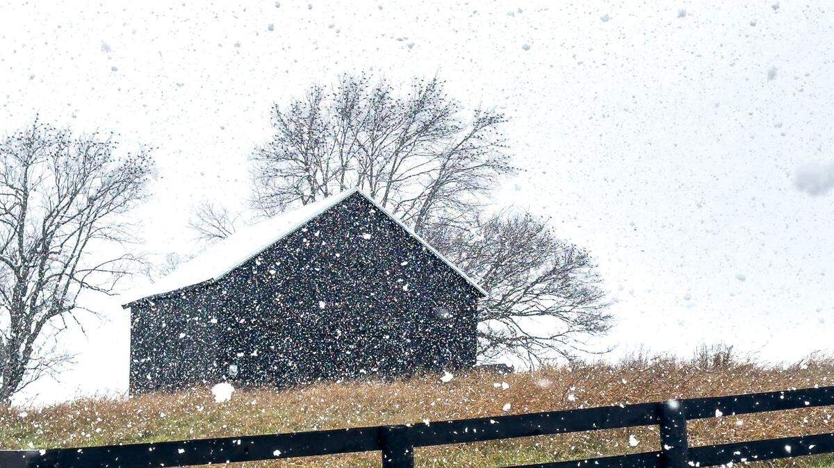
Major winter storm brings 7 inches of snow, heavy ice to Central Kentucky
READ MORE
Kentucky is hit with significant winter storm
The National Weather Service has issued a winter storm watch for many areas of the state.
Expand All
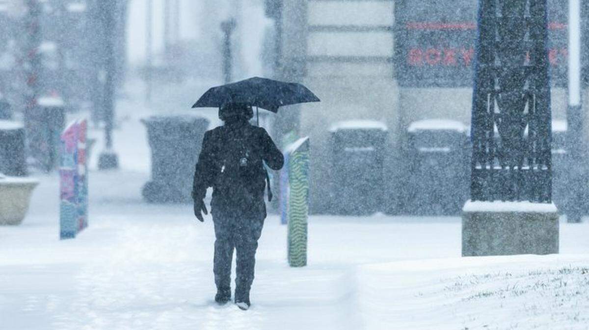
Kentucky battled dangerously slick road conditions, power outages and a bit more snow Monday, as Winter Storm Blair finished its course across the commonwealth.
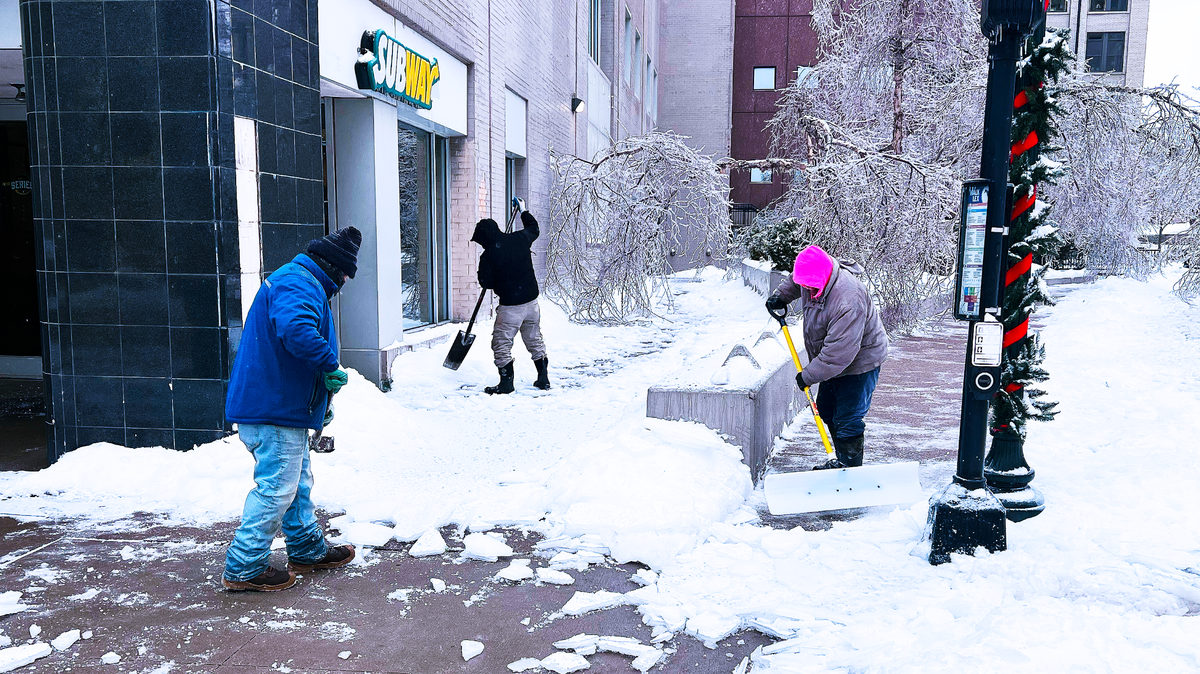
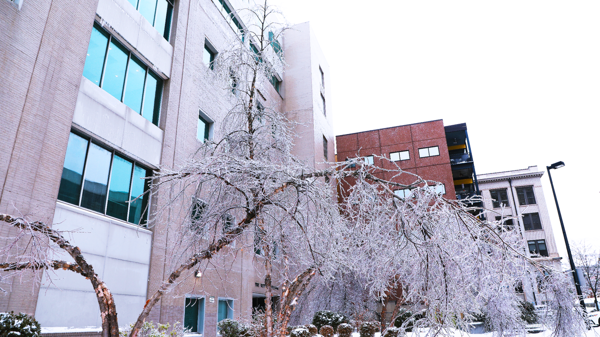
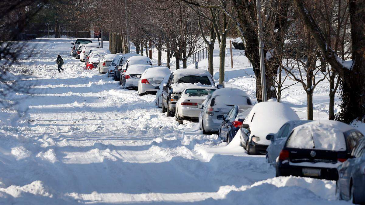
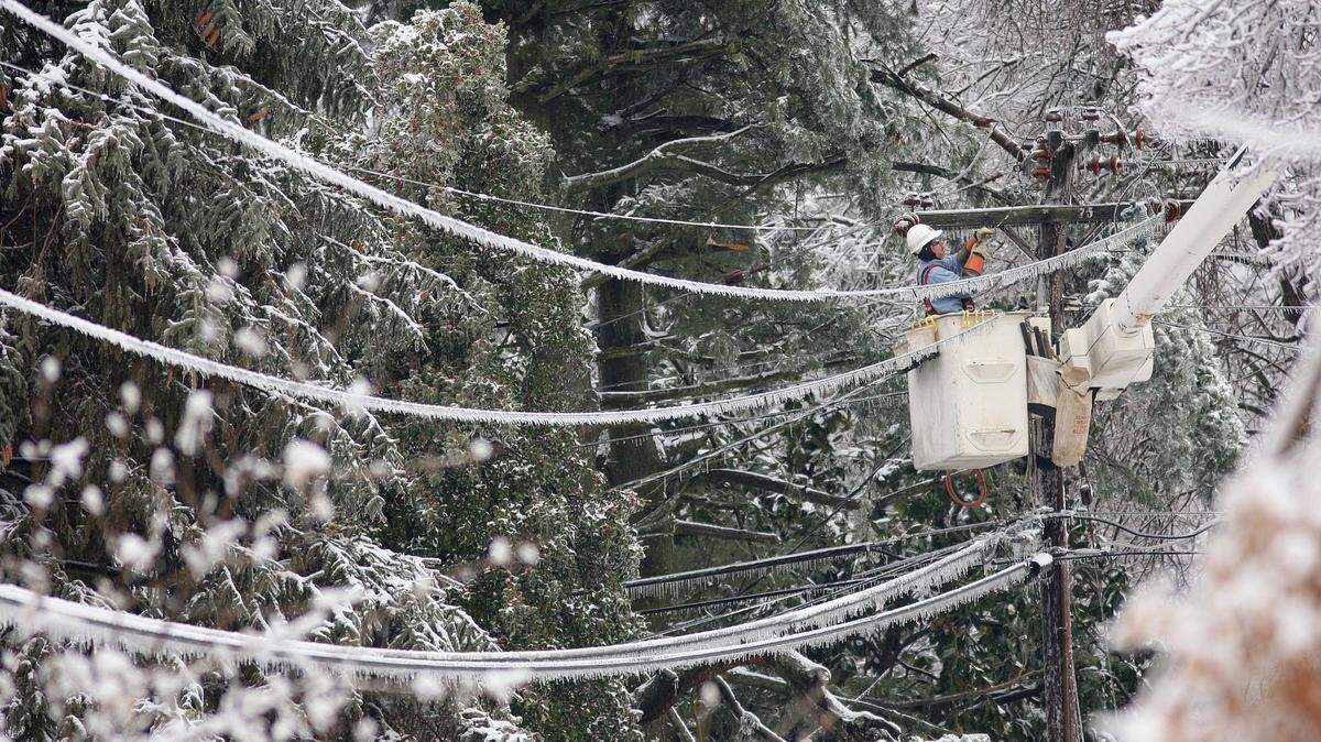
Kentuckians woke Monday to a coating of ice atop several inches of snow after the storm battered the state all day Sunday and overnight Monday morning. Six to 8 inches of snow were reported in many areas, topped by half an inch of ice.
Round two on Monday brought another inch or more to parts of Central Kentucky. Lexington’s two-day total for snowfall landed at 7 inches by late Monday afternoon.
“The problem now is, it’s going to get really cold,” said Brian Schoettmer, a meteorologist with the National Weather Service in Louisville.
Lexington Mayor Linda Gorton said late Monday afternoon that the majority of the city’s main roads were passable.
Side streets remained covered in a thick layer of ice, though Rob Allen, the city’s director of streets and roads, said crews hoped to begin working on neighborhood roads Monday evening.
Officials urged residents to avoid travel unless absolutely necessary.

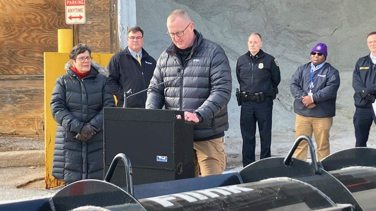
“The most important thing people can do today is stay home, stay safe,” Gov. Andy Beshear said at a news conference Monday morning. “This is a significant snow and ice event, so the roadways are still dangerous. You might be able to see the pavement, but that doesn’t mean that it’s not slick.”
Beshear planned to provide another update at noon Tuesday.
While crews made good progress clearing roads overnight, “even our interstates are still very slick,” Beshear said.
Beshear declared a state of emergency ahead of the storm, and more than 20 counties and 14 cities, including Lexington, have declared states of emergency, Kentucky Emergency Management Director Eric Gibson said.
Beshear said 2,300 Transportation Cabinet personnel would be working as hard as they could Monday to clear roads before a wave of cold descends on the state, meaning salt will no longer work for melting ice and snow.
“A half an inch of ice is very hard to treat, especially when it coats everything,” he said. “...Nearly every single road is icy.”
Beshear said Kentucky State Police had received reports of more than 170 crashes, 27 injury collisions and 280 stranded motorists by Monday morning.
He said he was not aware of any major injuries or deaths.

A winter storm warning remained in effect until 7 p.m. for Central Kentucky and until 1 a.m. Tuesday for the northeastern part of the state.
The precipitation will be followed by days of sub-freezing temperatures for the rest of the week. In Lexington, wind chills could be as low as -4 to -7 degrees by early Thursday morning.
“Be ready for several days of very cold weather,” said Ron Steve, a meteorologist for the National Weather Service in Louisville. “If you’re out of power, start looking at a plan to keep you and yours warm. ...It’s going to get cold.”
And more snow is possible beginning Friday, though it was too early Monday for accumulation predictions.

Because of the cold weather expected in the coming days, Beshear said Tuesday that people without power should be “thinking about the plans you may need to make” to get to a warm location.
“Counties with the most power outages have warming centers open,” the governor’s office said in a news release. “Those include Anderson, Bullitt, Clark, Fayette, Floyd, Hardin, Henderson, Johnson, Meade, Spencer and Union. This list is subject to change, and Kentuckians in need may contact their local emergency manager for further assistance.”
“We’re working with local officials to get the word out to those who have lost power and have medical devices that need to run. We need those folks to be moving toward a warming center,” Beshear said in the release.
While county emergency management officials should be the first called, people who can’t find a warming center or shelter can call 800-255-2587, Kentucky Emergency Management said in a social media post. .
In Lexington, people who need shelter or who see someone who may be in need were asked to call LexCall at 311 to be connected with the Office of Homelessness Prevention and Intervention. After business hours, people can call the Street Outreach team at (859) 551-8053 or (859) 556-1870, or call 911 in an emergency, the city said in a news release.
As of just before 8 a.m., more than 90,000 Kentuckians were without power, according to PowerOutage.us, which tracks outages across the nation. By 5:30 p.m., that number had decreased to about 50,000.
The tracker showed just over 5,000 outages as of 12:30 p.m. in Fayette County, and many in other counties along the Interstate 64 corridor had significant outages, as well. About 3,5000 customers in Fayette County were without power as of 5:30 p.m.
Several Eastern Kentucky counties, including Morgan, Menifee, Johnson, Martin and Lee, were also struggling with significant outages Monday.
Kentucky Power, which serves about 20 counties in Eastern Kentucky, said restoring power “will be a multi-day event.”
Beshear asked people to check on their neighbors.
“Let’s all look out for each other,” he said.
State officials also reminded people to use caution with generators and other heat sources.
Kentucky Emergency Management Director Eric Gibson said he knew of one house fire that started because of a generator being used in an enclosed space. Generators should be placed at least 20 feet from structures.
People should also remember to treat downed power lines as though they are live.
“Don’t touch them. Don’t drive over them,” Transportation Cabinet Secretary Jim Gray said at the news conference.
Gray reminded drivers to treat dark signals as four-way stops.
Police and fire departments were busy responding to reports of downed trees and power lines Monday.
Between 6 a.m. and 12:30 p.m., the Lexington Police Department responded to 57 non-injury collisions, eight injury collisions and 166 calls for motorist assistance, the city said in an update late Monday afternoon.
The Lexington Fire Department responded to 300 calls for service, including 32 calls about downed power lines, between late Sunday morning and 3 p.m. Monday, Fire Chief Jason Wells said at the news conference.
“If travel is essential, drivers should allow themselves plenty of time to reach their destination. Motorists are reminded to drive slowly, increase following distance, and be on the lookout for black ice,” police said in an earlier update.
Lexington city government said its crews worked overnight to clear roads and were continuing to do so Monday.
By 7 a.m. Monday, 1,200 tons of salt had been used, and the city was receiving a delivery of 2,000 more tons, said Allen, the streets and roads director.
He said his department had also responded to more than 75 calls about downed trees and had at least five crews working to clear them.
While parking on snow emergency routes is not prohibited at this time, Gorton said in a news release that “residents can help our street crews get the streets cleared by not parking on snow emergency routes.” Snow emergency routes in Lexington are marked with signage designating them as such and are main arteries for the city.
The city said in a news release Monday morning that its Emergency Operations Center was “partially activated, and all public safety divisions are on 24-hour schedules through Thursday, January 9.
“All city crews involved in snow removal duties are working alternating 12-hour shifts.”
Lextran was operating on a limited schedule Monday, with all routes starting at the Transit Center on Vine Street. For more information about the snow plan, go to Lextran.com and check the individual route page “Snow Plan” tab.
Most flights out of Blue Grass Airport were canceled Monday morning. The airport encouraged travelers to contact airlines for additional information on arrivals and departures.
Fayette County Public Schools will be closed Tuesday and Wednesday. Evening and after-school activities are also canceled Tuesday.
While Lexington’s parks are open, Raven Run Nature Sanctuary, Hisle Farm Park and McConnell Springs Park, as well as the city’s golf courses, will remain closed Tuesday.
There will be no city garbage pickup Tuesday.
Beshear said he anticipates state offices being open Tuesday, and he urged motorists to plan extra time for their commute.
Steve, of the National Weather Service, said the corridor along Bluegrass Parkway was “kind of ground zero for the ice,” while the area along the Interstate 64 corridor and northward got the brunt of the snow.
Lexington, he said, is at the confluence of those areas, and got both.
“The snow is a lot to clean up. It’s making for a pretty messy commute for some folks,” Steve said. “Probably the even bigger impact is from the ice.”
This story was originally published January 6, 2025 at 7:29 AM.